


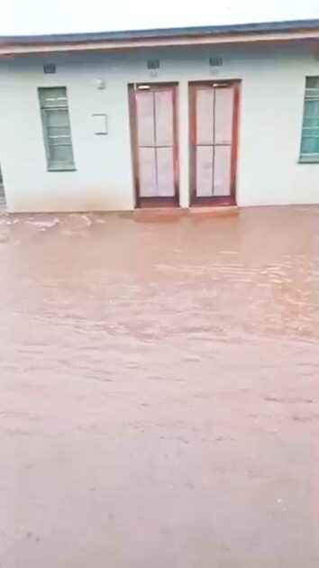
The staff camp at Satara has now flooded, and this is what it looked like before the employees were evacuated!
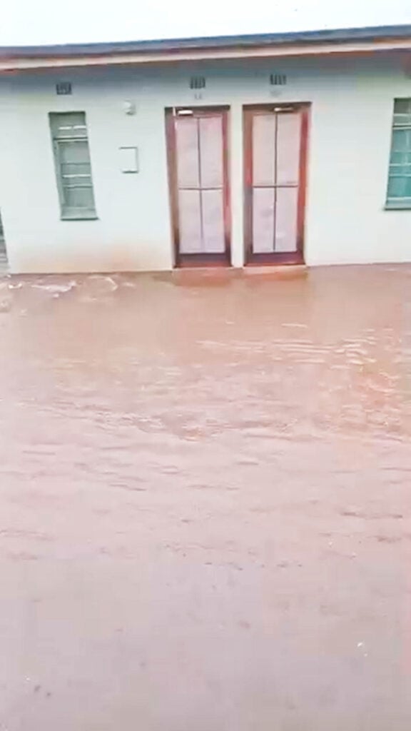
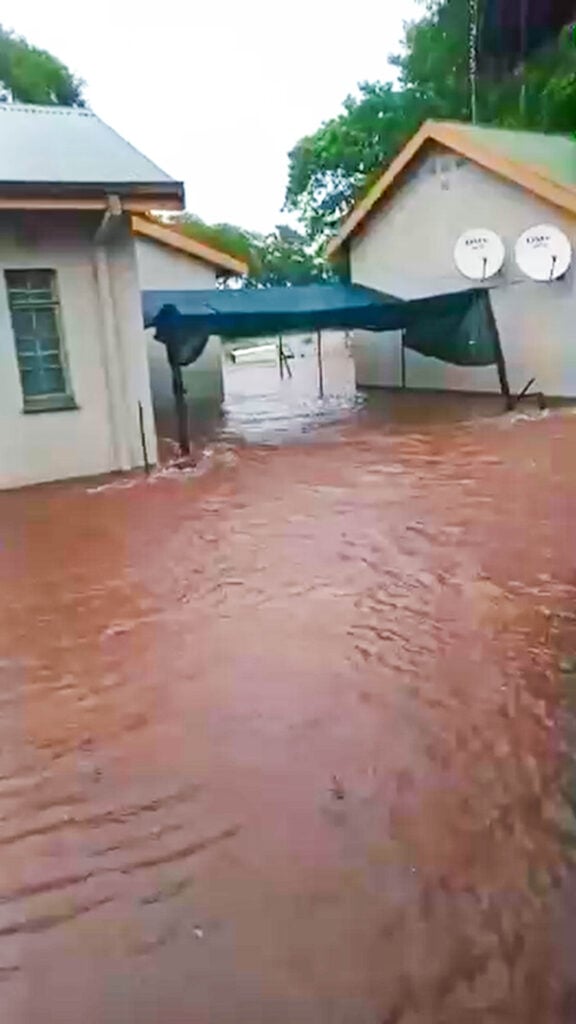
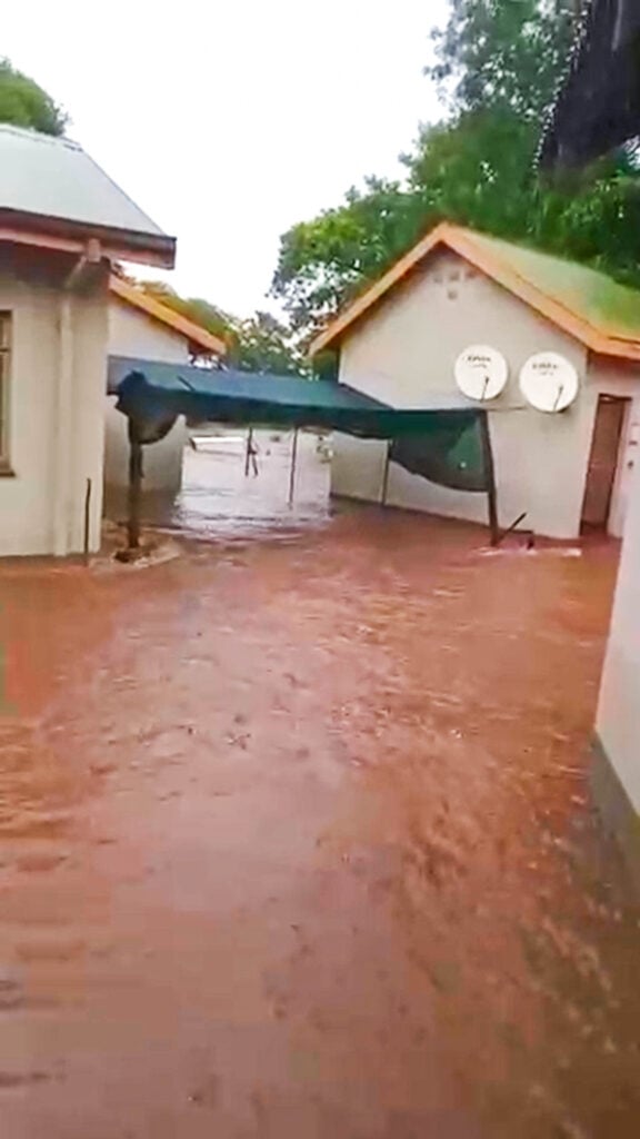
Fortunately, no injuries have been reported! However, staff members have sadly lost personal possessions, and there has been damage to infrastructure.
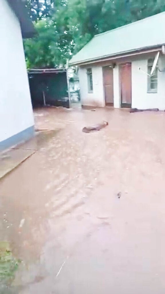
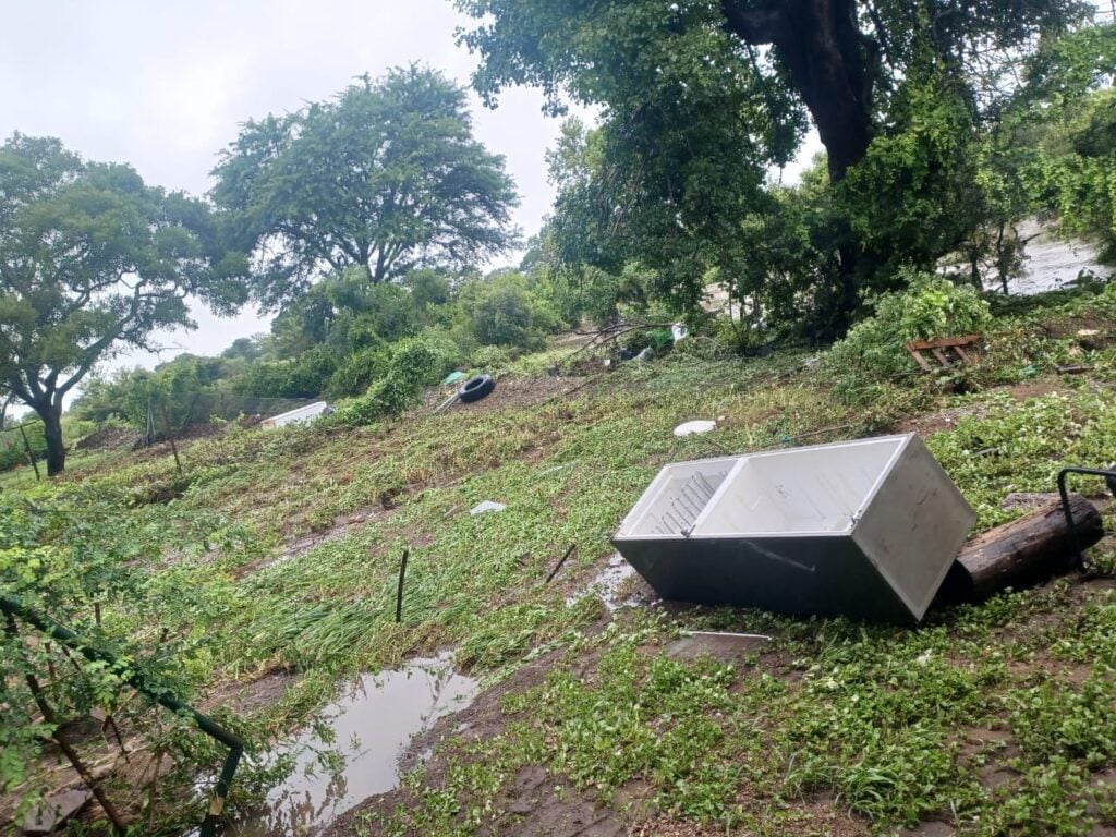
Take a Look This Fridge Taken With Flood:
Nsemani Dam Overflowing in Satara Area
Update on Kruger Floods
Over the past few weeks, relentless torrential rain has caused severe flooding in northeastern South Africa, particularly across our provinces, Limpopo and Mpumalanga.
The result of this has already claimed over 15 lives, and provincial authorities have reported more than 200 rescues of people stranded on rooftops and in trees. 100s of people have also been displaced from their homes.
In Kruger National Park, the flooding has led to the closure of several of its nine main entrances, with day visitor access suspended. Conditions have become so severe in some camps, like Letaba, that emergency evacuations were needed for both staff and guests.
It is still early, so details may change, but here is our take on the situation on the ground as it stands:
Most affected areas and rivers:
The worst flooding is in northern and eastern Limpopo, and eastern Mpumalanga, including large parts of Kruger National Park and surrounding communities.
Multiple major rivers have burst their banks due to the excessive rainfall. The most notable include:
Fast-flowing water has isolated large areas of the reserve, with some camps cut off until airlift evacuations could be done. Infrastructure damage includes collapsed roads and washed-away bridges, making travel extremely hazardous in affected zones.
Rainfall amounts and official warnings:
The South African Weather Service issued a rare Red Level 10 warning (our highest alert) on 15 January. And it warned of a further 100 to 200 mm of rain within 24 to 48 hours in parts of Limpopo and Mpumalanga.
Some forecasts have suggested that, in the hardest hit areas, more than 500 mm of rain may have fallen in a three-day period. Local officials in Mpumalanga have described the rains and floods as unlike anything seen in decades. In Kruger, water levels on the Letaba River have exceeded the benchmarks of the February 2000 floods, which were among the worst on record.
How the Flood Compares With the Norm:
Summer, from December to February, is the rainy season in this region. Some flooding is not uncommon during January and February, as rivers swell with seasonal rainfall. Kruger experiences annual wet season river rises, and low-lying roads or bridges often close temporarily during heavy rain.
But flooding at this scale is extremely rare. Many residents, guides, and rangers have described this as the worst they have seen.
Are levels rising or falling:
At the moment, most rivers in the region are still swollen, and in many areas, levels are still rising. Overall, water levels not decreased across the region, and emergency services and park officials continue to warn that conditions may still get worse before they improve.
The South African Weather Service said that weather conditions should only start improving after 19 January, so flood levels may remain high, or even rise further downstream, as runoff continues.
Stay tuned to Latest Sightings for all of the latest updates.